
Sitges topographic map
Interactive map
Click on the map to display elevation.
About this map
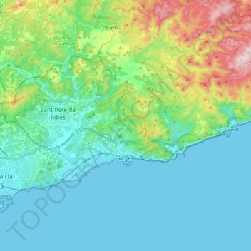
Name: Sitges topographic map, elevation, terrain.
Location: Sitges, Garraf, Barcelona, Catalonië, 08870, Spanje (41.21859 1.75620 41.29101 1.94455)
Average elevation: 130 m
Minimum elevation: -1 m
Maximum elevation: 591 m
Other topographic maps
Click on a map to view its topography, its elevation and its terrain.
Vilanova i la Geltrú
Vilanova i la Geltrú, Garraf, Barcelona, Catalonië, 08800, Spanje
Average elevation: 74 m