
Puerto Libertador topographic map
Interactive map
Click on the map to display elevation.
About this map
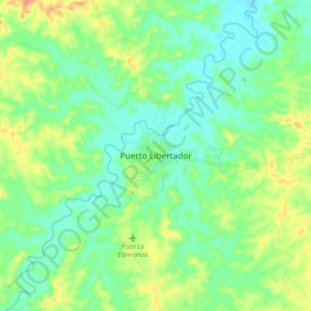
Name: Puerto Libertador topographic map, elevation, terrain.
Location: Puerto Libertador, Córdoba, Colombia (7.85003 -75.70955 7.93003 -75.62955)
Average elevation: 71 m
Minimum elevation: 50 m
Maximum elevation: 109 m