
Waterville topographic map
Interactive map
Click on the map to display elevation.
About this map
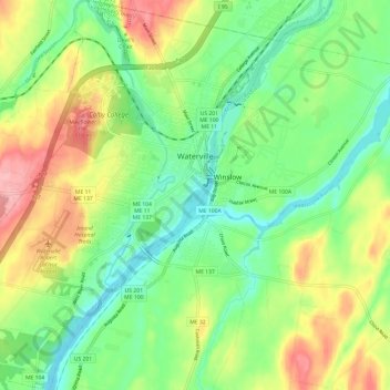
Name: Waterville topographic map, elevation, terrain.
Location: Waterville, Kennebec County, Maine, États-Unis d'Amérique (44.50048 -69.71988 44.58621 -69.60574)
Average elevation: 54 m
Minimum elevation: 7 m
Maximum elevation: 127 m
Other topographic maps
Click on a map to view its topography, its elevation and its terrain.
Gardiner
États-Unis d'Amérique > Maine > Kennebec County
Gardiner, Kennebec County, Maine, 04345, États-Unis d'Amérique
Average elevation: 52 m