
Thank you for supporting this site ❤️
Make a donation
Make a donation
Facha topographic map
Click on the map to display elevation.
Thank you for supporting this site ❤️
Make a donation
Make a donation
About this map
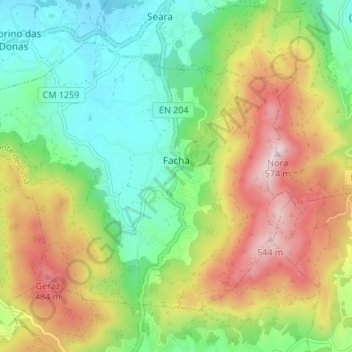
Name: Facha topographic map, elevation, terrain.
Location: Facha, Ponte de Lima, Viana do Castelo, 4990-600, Portugal (41.69244 -8.66173 41.73086 -8.59428)
Average elevation: 224 m
Minimum elevation: 4 m
Maximum elevation: 562 m
Thank you for supporting this site ❤️
Make a donation
Make a donation
Other topographic maps
Click on a map to view its topography, its elevation and its terrain.