
Samacá topographic map
Interactive map
Click on the map to display elevation.
About this map
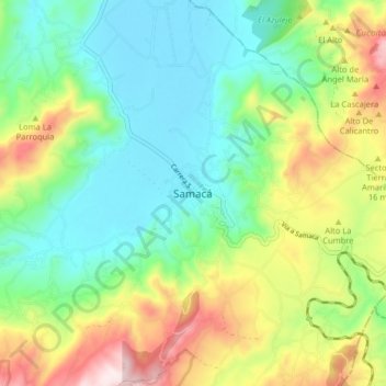
Name: Samacá topographic map, elevation, terrain.
Location: Samacá, Boyacá, Colombia (5.45179 -73.52529 5.53179 -73.44529)
Average elevation: 2,777 m
Minimum elevation: 2,581 m
Maximum elevation: 3,162 m
Other topographic maps
Click on a map to view its topography, its elevation and its terrain.