
Olot topographic map
Interactive map
Click on the map to display elevation.
About this map
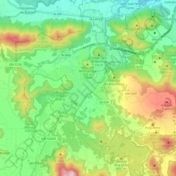
Name: Olot topographic map, elevation, terrain.
Location: Olot, Garrotxa, Gerona, Catalonië, Spanje (42.14974 2.44638 42.20532 2.54909)
Average elevation: 499 m
Minimum elevation: 293 m
Maximum elevation: 881 m
Olot is een plaats in de Spaanse autonome regio Catalonië, in de provincie Girona. Het is de hoofdstad van de comarca Garrotxa en ligt vlak bij de Pyreneeën, ongeveer 50 kilometer ten noordwesten van de stad Girona. Olot telt 34.000 inwoners (1 januari 2016). De plaats ligt midden in het Natuurpark "De Vulkanische Zone La Garrotxa" (ES: Zona Volcánica de la Garrotxa). Het hoogtepunt van dit natuurgebied is de 786 meter hoge vulkaan "Croscat".
Other topographic maps
Click on a map to view its topography, its elevation and its terrain.