
ท่าศาลา topographic map
Interactive map
Click on the map to display elevation.
About this map
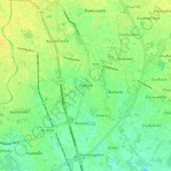
Name: ท่าศาลา topographic map, elevation, terrain.
Average elevation: 304 m
Minimum elevation: 294 m
Maximum elevation: 313 m
Other topographic maps
Click on a map to view its topography, its elevation and its terrain.
อ่างข่าง
Thailand > Provinz Chiang Mai > อ่างข่าง
อ่างข่าง, Provinz Chiang Mai, Thailand
Average elevation: 1,533 m