
Thank you for supporting this site ❤️
Make a donation
Make a donation
Sainte-Ode topographic map
Click on the map to display elevation.
Thank you for supporting this site ❤️
Make a donation
Make a donation
About this map
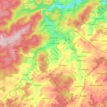
Name: Sainte-Ode topographic map, elevation, terrain.
Location: Sainte-Ode, Bastogne, Luxemburg, Wallonien, Belgien (49.95541 5.41480 50.07772 5.62971)
Average elevation: 462 m
Minimum elevation: 325 m
Maximum elevation: 589 m
Thank you for supporting this site ❤️
Make a donation
Make a donation
Other topographic maps
Click on a map to view its topography, its elevation and its terrain.
Thank you for supporting this site ❤️
Make a donation
Make a donation