
Thank you for supporting this site ❤️
Make a donation
Make a donation
Aliga topographic map
Click on the map to display elevation.
Thank you for supporting this site ❤️
Make a donation
Make a donation
About this map
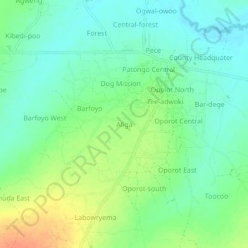
Name: Aliga topographic map, elevation, terrain.
Location: Aliga, Agago, Northern Region, Uganda (2.73460 33.28403 2.77460 33.32403)
Average elevation: 1,028 m
Minimum elevation: 1,013 m
Maximum elevation: 1,054 m
Thank you for supporting this site ❤️
Make a donation
Make a donation