
Thank you for supporting this site ❤️
Make a donation
Make a donation
Bluff Springs topographic map
Click on the map to display elevation.
Thank you for supporting this site ❤️
Make a donation
Make a donation
About this map
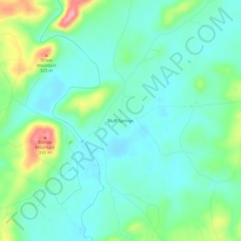
Name: Bluff Springs topographic map, elevation, terrain.
Location: Bluff Springs, Clay County, Alabama, United States (33.14345 -85.84746 33.18345 -85.80746)
Average elevation: 245 m
Minimum elevation: 214 m
Maximum elevation: 332 m
Thank you for supporting this site ❤️
Make a donation
Make a donation
Other topographic maps
Click on a map to view its topography, its elevation and its terrain.