
Thank you for supporting this site ❤️
Make a donation
Make a donation
Shamli topographic map
Click on the map to display elevation.
Thank you for supporting this site ❤️
Make a donation
Make a donation
About this map
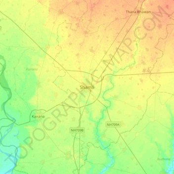
Name: Shamli topographic map, elevation, terrain.
Location: Shamli, Uttar Pradesh, 247776, India (29.28835 77.14877 29.60835 77.46877)
Average elevation: 242 m
Minimum elevation: 226 m
Maximum elevation: 257 m
Thank you for supporting this site ❤️
Make a donation
Make a donation