
Thank you for supporting this site ❤️
Make a donation
Make a donation
Harrisville topographic map
Click on the map to display elevation.
Thank you for supporting this site ❤️
Make a donation
Make a donation
About this map
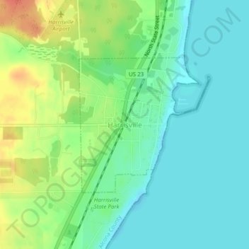
Name: Harrisville topographic map, elevation, terrain.
Location: Harrisville, Alcona County, Michigan, United States (44.64907 -83.30167 44.66370 -83.28170)
Average elevation: 188 m
Minimum elevation: 172 m
Maximum elevation: 220 m
Thank you for supporting this site ❤️
Make a donation
Make a donation
Other topographic maps
Click on a map to view its topography, its elevation and its terrain.