
Thank you for supporting this site ❤️
Make a donation
Make a donation
Asinge topographic map
Click on the map to display elevation.
Thank you for supporting this site ❤️
Make a donation
Make a donation
About this map
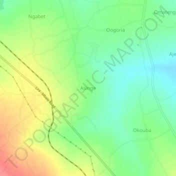
Name: Asinge topographic map, elevation, terrain.
Location: Asinge, Kumi, Eastern Region, Uganda (1.52423 33.88119 1.56423 33.92119)
Average elevation: 1,097 m
Minimum elevation: 1,066 m
Maximum elevation: 1,140 m
Thank you for supporting this site ❤️
Make a donation
Make a donation
Other topographic maps
Click on a map to view its topography, its elevation and its terrain.