
Thank you for supporting this site ❤️
Make a donation
Make a donation
Schulzendorf topographic map
Click on the map to display elevation.
Thank you for supporting this site ❤️
Make a donation
Make a donation
About this map
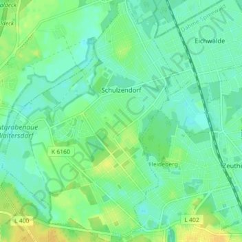
Name: Schulzendorf topographic map, elevation, terrain.
Location: Schulzendorf, Dahme-Spreewald, Brandenburg, 15732, Germany (52.33726 13.56126 52.38026 13.61351)
Average elevation: 40 m
Minimum elevation: 32 m
Maximum elevation: 53 m
Thank you for supporting this site ❤️
Make a donation
Make a donation
Other topographic maps
Click on a map to view its topography, its elevation and its terrain.
Siedlung Waldesruh
Germany > Brandenburg > Dahme-Spreewald > Königs Wusterhausen
Average elevation: 41 m