
Nouvelle-Angleterre topographic map
Interactive map
Click on the map to display elevation.
About this map
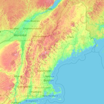
Name: Nouvelle-Angleterre topographic map, elevation, terrain.
Location: Nouvelle-Angleterre, Oxford County, Maine, États-Unis (40.94926 -73.72778 47.45984 -66.88554)
Average elevation: 204 m
Minimum elevation: -3 m
Maximum elevation: 1,705 m
Other topographic maps
Click on a map to view its topography, its elevation and its terrain.
The Sugarloaf
The Sugarloaf, Hancock County, Maine, 04660, États-Unis
Average elevation: 31 m