
Vereda el Palmar topographic map
Interactive map
Click on the map to display elevation.
About this map
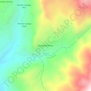
Name: Vereda el Palmar topographic map, elevation, terrain.
Location: Vereda el Palmar, Guaca, García Rovira, Santander, Colombia (6.86646 -72.84467 6.90646 -72.80467)
Average elevation: 2,524 m
Minimum elevation: 2,028 m
Maximum elevation: 3,296 m