
Thank you for supporting this site ❤️
Make a donation
Make a donation
Oruanui topographic map
Click on the map to display elevation.
Thank you for supporting this site ❤️
Make a donation
Make a donation
About this map
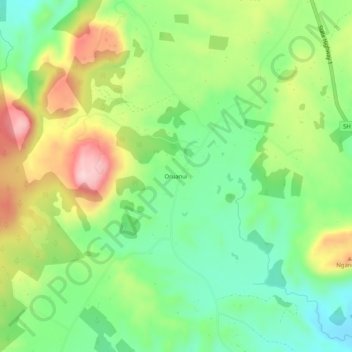
Name: Oruanui topographic map, elevation, terrain.
Location: Oruanui, Taupō District, Waikato, New Zealand (-38.59666 176.00502 -38.55666 176.04502)
Average elevation: 564 m
Minimum elevation: 465 m
Maximum elevation: 717 m
Thank you for supporting this site ❤️
Make a donation
Make a donation
Other topographic maps
Click on a map to view its topography, its elevation and its terrain.