
Thank you for supporting this site ❤️
Make a donation
Make a donation
Wiffertshausen topographic map
Click on the map to display elevation.
Thank you for supporting this site ❤️
Make a donation
Make a donation
About this map
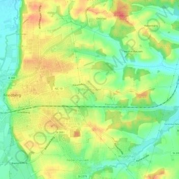
Name: Wiffertshausen topographic map, elevation, terrain.
Average elevation: 502 m
Minimum elevation: 474 m
Maximum elevation: 532 m
Thank you for supporting this site ❤️
Make a donation
Make a donation
Other topographic maps
Click on a map to view its topography, its elevation and its terrain.
Friedberger Baggersee
Deutschland > Bayern > Landkreis Aichach-Friedberg > Friedberg
Average elevation: 485 m
86316
Deutschland > Bayern > Landkreis Aichach-Friedberg > Friedberg > Wiffertshausen
Average elevation: 496 m