
Lower Turkeyfoot Township topographic map
Interactive map
Click on the map to display elevation.
About this map
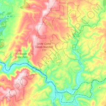
Name: Lower Turkeyfoot Township topographic map, elevation, terrain.
Average elevation: 611 m
Minimum elevation: 377 m
Maximum elevation: 891 m
Other topographic maps
Click on a map to view its topography, its elevation and its terrain.
Cover Hill
États-Unis d'Amérique > Pennsylvanie > Somerset County > Brothersvalley Township
Cover Hill, Brothersvalley Township, Somerset County, Pennsylvanie, 15510, États-Unis d'Amérique
Average elevation: 768 m