
Provincia Constitucional del Callao topographic map
Interactive map
Click on the map to display elevation.
About this map
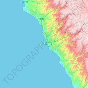
Name: Provincia Constitucional del Callao topographic map, elevation, terrain.
Location: Provincia Constitucional del Callao, Callao, 07021, Perú (-12.08667 -77.17000 -12.04667 -77.13000)
Average elevation: 2 m
Minimum elevation: 0 m
Maximum elevation: 19 m
Other topographic maps
Click on a map to view its topography, its elevation and its terrain.
Parque Papa Benedicto XVI
Parque Papa Benedicto XVI, Urbanización Santa Marina, Callao, Perú
Average elevation: 33 m