
Thank you for supporting this site ❤️
Make a donation
Make a donation
Lorong Halus topographic map
Click on the map to display elevation.
Thank you for supporting this site ❤️
Make a donation
Make a donation
About this map
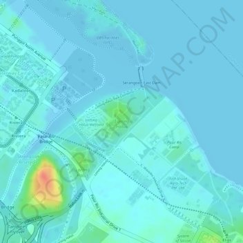
Name: Lorong Halus topographic map, elevation, terrain.
Location: Lorong Halus, Pasir Ris, Northeast, Singapore (1.39163 103.92399 1.39944 103.93247)
Average elevation: 6 m
Minimum elevation: -3 m
Maximum elevation: 52 m
Thank you for supporting this site ❤️
Make a donation
Make a donation