
Guéry topographic map
Interactive map
Click on the map to display elevation.
About this map
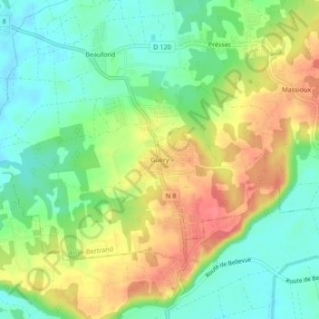
Name: Guéry topographic map, elevation, terrain.
Average elevation: 39 m
Minimum elevation: 9 m
Maximum elevation: 78 m
Other topographic maps
Click on a map to view its topography, its elevation and its terrain.
Campêche
France > Guadeloupe > Anse-Bertrand
Campêche, Anse-Bertrand, Pointe-à-Pitre, Guadeloupe, 97121, France
Average elevation: 33 m