
Thank you for supporting this site ❤️
Make a donation
Make a donation
Wijnaldum topographic map
Click on the map to display elevation.
Thank you for supporting this site ❤️
Make a donation
Make a donation
About this map
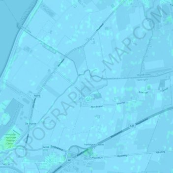
Name: Wijnaldum topographic map, elevation, terrain.
Location: Wijnaldum, Harlingen, Frisia, Netherlands (53.18559 5.43037 53.20987 5.49018)
Average elevation: 0 m
Minimum elevation: -4 m
Maximum elevation: 4 m
Thank you for supporting this site ❤️
Make a donation
Make a donation
Other topographic maps
Click on a map to view its topography, its elevation and its terrain.