
Weidenhausen topographic map
Interactive map
Click on the map to display elevation.
About this map
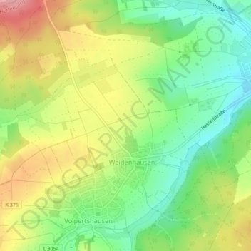
Name: Weidenhausen topographic map, elevation, terrain.
Location: Weidenhausen, Hüttenberg, Lahn-Dill-Kreis, Hessen, Deutschland (50.50421 8.53690 50.52053 8.56229)
Average elevation: 266 m
Minimum elevation: 209 m
Maximum elevation: 338 m
Other topographic maps
Click on a map to view its topography, its elevation and its terrain.
Volpertshausen
Deutschland > Hessen > Lahn-Dill-Kreis > Hüttenberg
Volpertshausen, Hüttenberg, Lahn-Dill-Kreis, Hessen, 35625, Deutschland
Average elevation: 282 m