Geolocate

Moquegua topographic map

Interactive map

Click on the map to display elevation.

About this map

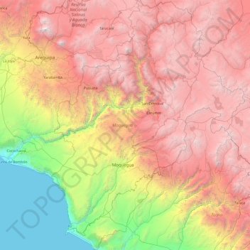
Name: Moquegua topographic map, elevation, terrain.

Location: Moquegua, Perú (-17.82148 -71.49080 -15.97596 -69.99505)

Average elevation: 2,772 m

Minimum elevation: 0 m

Maximum elevation: 6,054 m

Other topographic maps

Click on a map to view its topography, its elevation and its terrain.

Torca

Perú > Moquegua > Talahuayo

Torca, Talahuayo, La Capilla, General Sánchez Cerro, Moquegua, Perú

Average elevation: 2,291 m

Provincia de Ilo

Perú > Moquegua

Provincia de Ilo, Moquegua, 18601, Perú

Average elevation: 652 m

Charaque

Perú > Moquegua > Torata > Charaque

Charaque, Torata, Provincia de Mariscal Nieto, Moquegua, Perú

Average elevation: 3,884 m

Carrizal

Perú > Moquegua > Carrizal

Carrizal, General Sánchez Cerro, Moquegua, Perú

Average elevation: 2,572 m