
Thank you for supporting this site ❤️
Make a donation
Make a donation
Ellerau topographic map
Click on the map to display elevation.
Thank you for supporting this site ❤️
Make a donation
Make a donation
About this map
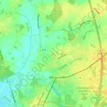
Name: Ellerau topographic map, elevation, terrain.
Location: Ellerau, Kreis Segeberg, Schleswig-Holstein, 25479, Deutschland (53.74732 9.89256 53.77207 9.96578)
Average elevation: 25 m
Minimum elevation: 12 m
Maximum elevation: 39 m
Thank you for supporting this site ❤️
Make a donation
Make a donation
Other topographic maps
Click on a map to view its topography, its elevation and its terrain.