
Thank you for supporting this site ❤️
Make a donation
Make a donation
Hancock Chapel topographic map
Click on the map to display elevation.
Thank you for supporting this site ❤️
Make a donation
Make a donation
About this map
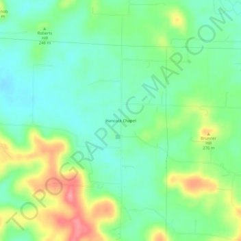
Name: Hancock Chapel topographic map, elevation, terrain.
Location: Hancock Chapel, Harrison County, Indiana, United States (38.36173 -86.19942 38.40173 -86.15942)
Average elevation: 234 m
Minimum elevation: 201 m
Maximum elevation: 295 m
Thank you for supporting this site ❤️
Make a donation
Make a donation
Other topographic maps
Click on a map to view its topography, its elevation and its terrain.