
Thank you for supporting this site ❤️
Make a donation
Make a donation
Papagayo topographic map
Click on the map to display elevation.
Thank you for supporting this site ❤️
Make a donation
Make a donation
About this map
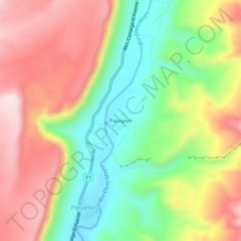
Name: Papagayo topographic map, elevation, terrain.
Average elevation: 2,556 m
Minimum elevation: 2,354 m
Maximum elevation: 2,772 m
Thank you for supporting this site ❤️
Make a donation
Make a donation
Other topographic maps
Click on a map to view its topography, its elevation and its terrain.
Camargo
Bolivia > Chuquisaca > Provincia Nor Cinti > Municipio Camargo
Camargo is the capital of Nor Cinti Province and is situated in Camargo Municipio, embedded between north-southerly mountain ridges, at an elevation of 2,414 m, on the banks of Río Chico which later becomes Río Pilaya.
Average elevation: 2,499 m