
Town of Plattekill topographic map
Interactive map
Click on the map to display elevation.
About this map
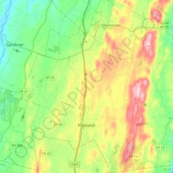
Name: Town of Plattekill topographic map, elevation, terrain.
Location: Town of Plattekill, Ulster County, New York, United States (41.58039 -74.14425 41.71396 -74.01338)
Average elevation: 162 m
Minimum elevation: 57 m
Maximum elevation: 330 m