
Thank you for supporting this site ❤️
Make a donation
Make a donation
Lake O'Hara topographic map
Click on the map to display elevation.
Thank you for supporting this site ❤️
Make a donation
Make a donation
Lake O'Hara
Lake O'Hara is a lake at an elevation of 2,020 metres (6,630 ft) in the alpine area of Yoho National Park, in the province of British Columbia, on the western side of the Great Divide with the province of Alberta and Banff National Park to the east. The lake and the valley are accessible through a bus service that is run by Parks Canada or by an 11 km hike along a road with an elevation gain of approximately 500m.
Thank you for supporting this site ❤️
Make a donation
Make a donation
About this map
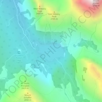
Name: Lake O'Hara topographic map, elevation, terrain.
Average elevation: 2,276 m
Minimum elevation: 1,969 m
Maximum elevation: 3,232 m
Thank you for supporting this site ❤️
Make a donation
Make a donation