
Thank you for supporting this site ❤️
Make a donation
Make a donation
Mount Pleasant topographic map
Click on the map to display elevation.
Thank you for supporting this site ❤️
Make a donation
Make a donation
About this map
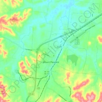
Name: Mount Pleasant topographic map, elevation, terrain.
Average elevation: 211 m
Minimum elevation: 174 m
Maximum elevation: 292 m
Thank you for supporting this site ❤️
Make a donation
Make a donation
Other topographic maps
Click on a map to view its topography, its elevation and its terrain.
Thank you for supporting this site ❤️
Make a donation
Make a donation
Highland Park
United States > Tennessee > Maury County > Columbia > Highland Park
Average elevation: 209 m
Thank you for supporting this site ❤️
Make a donation
Make a donation