
Sasso Lungo topographic map
Interactive map
Click on the map to display elevation.
About this map
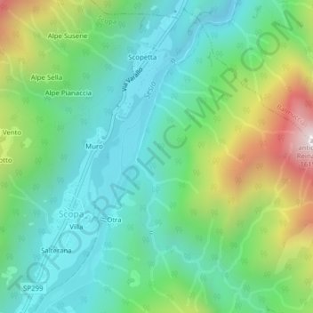
Name: Sasso Lungo topographic map, elevation, terrain.
Location: Sasso Lungo, Otra, Scopa, Vercelli, Piedmont, 13027, Italy (45.78756 8.11396 45.80756 8.13396)
Average elevation: 854 m
Minimum elevation: 564 m
Maximum elevation: 1,557 m