
Thank you for supporting this site ❤️
Make a donation
Make a donation
Kamern topographic map
Click on the map to display elevation.
Thank you for supporting this site ❤️
Make a donation
Make a donation
Kamern
Aland | Altmärkische Höhe | Altmärkische Wische | Arneburg | Bismark (Altmark) | Eichstedt (Altmark) | Goldbeck | Hassel | Havelberg | Hohenberg-Krusemark | Iden | Kamern | Klietz | Osterburg (Altmark) | Rochau | Sandau (Elbe) | Schollene | Schönhausen (Elbe) | Seehausen (Altmark) | Stendal | Tangerhütte | Tangermünde | Werben (Elbe) | Wust-Fischbeck | Zehrental
Thank you for supporting this site ❤️
Make a donation
Make a donation
About this map
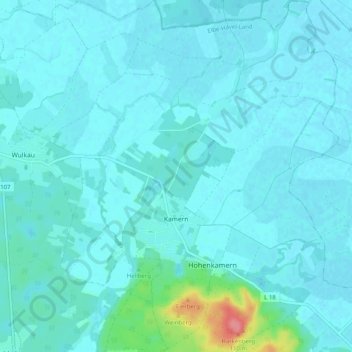
Name: Kamern topographic map, elevation, terrain.
Location: Kamern, Elbe-Havel-Land, Stendal, Sachsen-Anhalt, Deutschland (52.72678 12.09096 52.78773 12.15958)
Average elevation: 32 m
Minimum elevation: 24 m
Maximum elevation: 100 m
Thank you for supporting this site ❤️
Make a donation
Make a donation
Other topographic maps
Click on a map to view its topography, its elevation and its terrain.