
Thank you for supporting this site ❤️
Make a donation
Make a donation
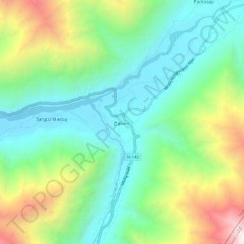
Mastuj topographic map
Click on the map to display elevation.
Thank you for supporting this site ❤️
Make a donation
Make a donation
Mastuj
Mastuj (Urdu: مستوج) is a town and Tehsil of Upper Chitral District in Khyber-Pakhtunkhwa province of Pakistan. It is located at 36°17'0N 72°31'0E with an altitude of 2359 metres (7742 feet). There are ruins of old fort built originally in 18th century and reconstructed several times.
Thank you for supporting this site ❤️
Make a donation
Make a donation
About this map
Name: Mastuj topographic map, elevation, terrain.
Average elevation: 3,059 m
Minimum elevation: 2,238 m
Maximum elevation: 5,067 m
Thank you for supporting this site ❤️
Make a donation
Make a donation
Other topographic maps
Click on a map to view its topography, its elevation and its terrain.