
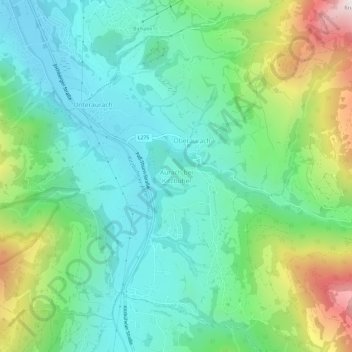
Aurach bei Kitzbühel topographic map
Interactive map
Click on the map to display elevation.
About this map
Name: Aurach bei Kitzbühel topographic map, elevation, terrain.
Average elevation: 1,028 m
Minimum elevation: 765 m
Maximum elevation: 1,696 m
Other topographic maps
Click on a map to view its topography, its elevation and its terrain.
Unteraurach
Oostenrijk > Tirol > Bezirk Kitzbühel > Gemeinde Aurach bei Kitzbühel
Unteraurach, Gemeinde Aurach bei Kitzbühel, Bezirk Kitzbühel, Tirol, 6371, Oostenrijk
Average elevation: 1,003 m