
Thank you for supporting this site ❤️
Make a donation
Make a donation
Huai topographic map
Click on the map to display elevation.
Thank you for supporting this site ❤️
Make a donation
Make a donation
About this map
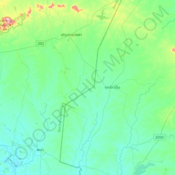
Name: Huai topographic map, elevation, terrain.
Location: Huai, Amnat Charoen Province, Thailand (15.62922 104.78511 15.94922 105.10511)
Average elevation: 158 m
Minimum elevation: 119 m
Maximum elevation: 338 m
Thank you for supporting this site ❤️
Make a donation
Make a donation