
Thank you for supporting this site ❤️
Make a donation
Make a donation
Aldea topographic map
Click on the map to display elevation.
Thank you for supporting this site ❤️
Make a donation
Make a donation
About this map
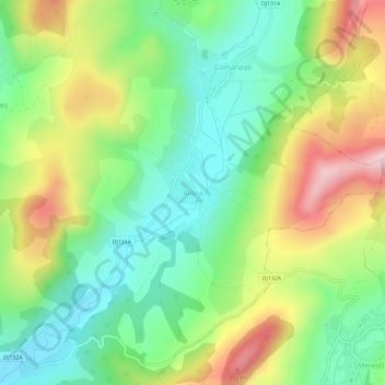
Name: Aldea topographic map, elevation, terrain.
Location: Aldea, Mărtiniș, Harghita, 537176, Romania (46.23249 25.41422 46.27249 25.45422)
Average elevation: 621 m
Minimum elevation: 492 m
Maximum elevation: 829 m
Thank you for supporting this site ❤️
Make a donation
Make a donation
Other topographic maps
Click on a map to view its topography, its elevation and its terrain.