
Thank you for supporting this site ❤️
Make a donation
Make a donation
Trasenster topographic map
Click on the map to display elevation.
Thank you for supporting this site ❤️
Make a donation
Make a donation
About this map
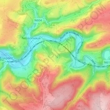
Name: Trasenster topographic map, elevation, terrain.
Location: Trasenster, Fraipont, Trooz, Liège, Wallonie, 4870, Belgique (50.54748 5.73066 50.58748 5.77066)
Average elevation: 208 m
Minimum elevation: 97 m
Maximum elevation: 322 m
Thank you for supporting this site ❤️
Make a donation
Make a donation