
Thank you for supporting this site ❤️
Make a donation
Make a donation
Ugborough topographic map
Click on the map to display elevation.
Thank you for supporting this site ❤️
Make a donation
Make a donation
About this map
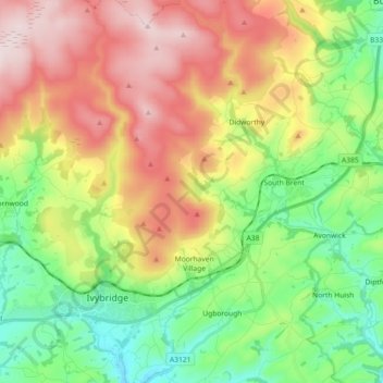
Name: Ugborough topographic map, elevation, terrain.
Location: Ugborough, South Hams, Devon, England, United Kingdom (50.36613 -3.92651 50.48125 -3.80543)
Average elevation: 215 m
Minimum elevation: 17 m
Maximum elevation: 490 m
Thank you for supporting this site ❤️
Make a donation
Make a donation
Other topographic maps
Click on a map to view its topography, its elevation and its terrain.