
Thank you for supporting this site ❤️
Make a donation
Make a donation
Hartselle topographic map
Click on the map to display elevation.
Thank you for supporting this site ❤️
Make a donation
Make a donation
About this map
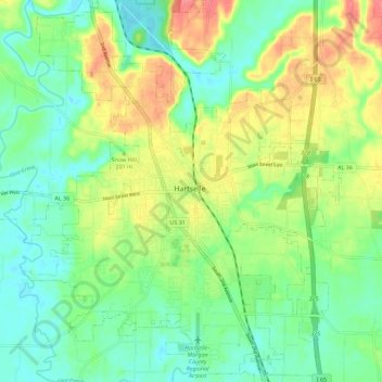
Name: Hartselle topographic map, elevation, terrain.
Location: Hartselle, Morgan County, Alabama, 35640, United States (34.39835 -87.00323 34.48733 -86.89054)
Average elevation: 196 m
Minimum elevation: 169 m
Maximum elevation: 242 m
Thank you for supporting this site ❤️
Make a donation
Make a donation