
Lake Bullen Merri topographic map
Interactive map
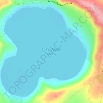
Click on the map to display elevation.
About this map
Name: Lake Bullen Merri topographic map, elevation, terrain.
Average elevation: 171 m
Minimum elevation: 139 m
Maximum elevation: 281 m
The smaller lake to the north of Lake Bullen Merri has a maximum depth of 20 m (66 ft). The two lakes are linked by an overflow channel in the common wall at an elevation of 175 m. There is a 19th-century record of water from Bullen Merri overflowing into Gnotuk.
Other topographic maps
Click on a map to view its topography, its elevation and its terrain.
Mount Sugarloaf
Australia > Victoria > Camperdown
Mount Sugarloaf, Camperdown, Shire of Corangamite, Victoria, 3260, Australia
Average elevation: 201 m
Camperdown
Australia > Victoria > Camperdown
Camperdown, Shire of Corangamite, Barwon South West, Victoria, 3260, Australia
Average elevation: 170 m