
Thank you for supporting this site ❤️
Make a donation
Make a donation
Springvale Township topographic map
Click on the map to display elevation.
Thank you for supporting this site ❤️
Make a donation
Make a donation
About this map
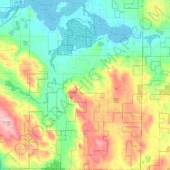
Name: Springvale Township topographic map, elevation, terrain.
Location: Springvale Township, Emmet County, Michigan, United States (45.28934 -84.85395 45.41903 -84.72990)
Average elevation: 255 m
Minimum elevation: 179 m
Maximum elevation: 394 m
Thank you for supporting this site ❤️
Make a donation
Make a donation
Other topographic maps
Click on a map to view its topography, its elevation and its terrain.