
Thank you for supporting this site ❤️
Make a donation
Make a donation
Lead Hill topographic map
Click on the map to display elevation.
Thank you for supporting this site ❤️
Make a donation
Make a donation
About this map
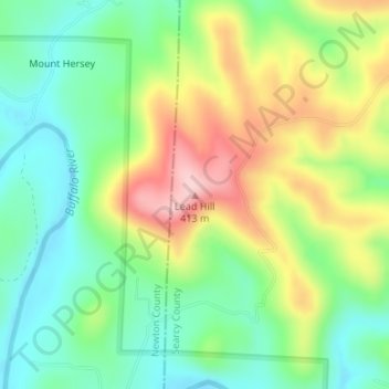
Name: Lead Hill topographic map, elevation, terrain.
Location: Lead Hill, Searcy County, Arkansas, United States (36.00447 -92.93883 36.00457 -92.93873)
Average elevation: 286 m
Minimum elevation: 204 m
Maximum elevation: 415 m
Thank you for supporting this site ❤️
Make a donation
Make a donation
Other topographic maps
Click on a map to view its topography, its elevation and its terrain.