
Thank you for supporting this site ❤️
Make a donation
Make a donation
Wulmstorf topographic map
Click on the map to display elevation.
Thank you for supporting this site ❤️
Make a donation
Make a donation
About this map
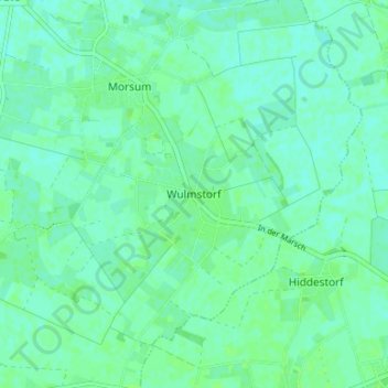
Name: Wulmstorf topographic map, elevation, terrain.
Average elevation: 11 m
Minimum elevation: 7 m
Maximum elevation: 15 m
Thank you for supporting this site ❤️
Make a donation
Make a donation
Other topographic maps
Click on a map to view its topography, its elevation and its terrain.
Blender
Deutschland > Niedersachsen > Landkreis Verden > Samtgemeinde Thedinghausen
Average elevation: 12 m
Einste
Deutschland > Niedersachsen > Landkreis Verden > Samtgemeinde Thedinghausen > Blender
Average elevation: 12 m
Riede
Deutschland > Niedersachsen > Landkreis Verden > Samtgemeinde Thedinghausen
Average elevation: 9 m