
Thank you for supporting this site ❤️
Make a donation
Make a donation
Baie topographic map
Click on the map to display elevation.
Thank you for supporting this site ❤️
Make a donation
Make a donation
About this map
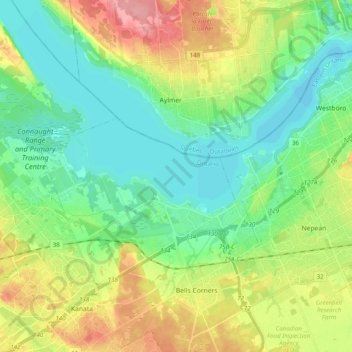
Name: Baie topographic map, elevation, terrain.
Location: Baie, Nepean, Ottawa, Est de l'Ontario, Ontario, Canada (45.32034 -75.94558 45.40939 -75.74835)
Average elevation: 82 m
Minimum elevation: 50 m
Maximum elevation: 144 m
Thank you for supporting this site ❤️
Make a donation
Make a donation
Other topographic maps
Click on a map to view its topography, its elevation and its terrain.