
Oudler topographic map
Interactive map
Click on the map to display elevation.
About this map
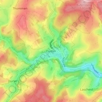
Name: Oudler topographic map, elevation, terrain.
Location: Oudler, Verviers, Luik, Wallonië, 4790, België (50.18231 6.07337 50.22231 6.11337)
Average elevation: 456 m
Minimum elevation: 369 m
Maximum elevation: 538 m