
Thank you for supporting this site ❤️
Make a donation
Make a donation
Canada Verde topographic map
Click on the map to display elevation.
Thank you for supporting this site ❤️
Make a donation
Make a donation
About this map
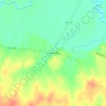
Name: Canada Verde topographic map, elevation, terrain.
Location: Canada Verde, Wilson County, Texas, United States (29.17191 -98.29557 29.21191 -98.25557)
Average elevation: 137 m
Minimum elevation: 114 m
Maximum elevation: 167 m
Thank you for supporting this site ❤️
Make a donation
Make a donation
Other topographic maps
Click on a map to view its topography, its elevation and its terrain.