
Osedo topographic map
Interactive map
Click on the map to display elevation.
About this map
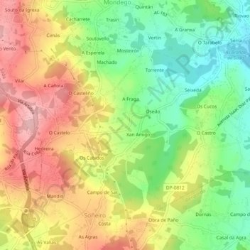
Name: Osedo topographic map, elevation, terrain.
Location: Osedo, Soñeiro, Sada, A Coruña, Galicië, 15168, Spanje (43.32885 -8.30369 43.35036 -8.25770)
Average elevation: 88 m
Minimum elevation: 4 m
Maximum elevation: 178 m