
Gemeinde Andelsbuch topographic map
Interactive map
Click on the map to display elevation.
About this map
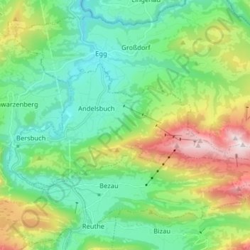
Name: Gemeinde Andelsbuch topographic map, elevation, terrain.
Location: Gemeinde Andelsbuch, Bezirk Bregenz, Vorarlberg, Autriche (47.38503 9.84913 47.42792 9.97815)
Average elevation: 865 m
Minimum elevation: 502 m
Maximum elevation: 1,759 m