
Thank you for supporting this site ❤️
Make a donation
Make a donation
Har Reihan topographic map
Click on the map to display elevation.
Thank you for supporting this site ❤️
Make a donation
Make a donation
About this map
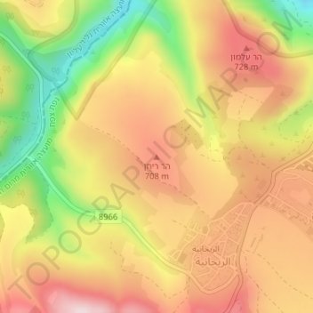
Name: Har Reihan topographic map, elevation, terrain.
Average elevation: 634 m
Minimum elevation: 424 m
Maximum elevation: 790 m
Thank you for supporting this site ❤️
Make a donation
Make a donation
Other topographic maps
Click on a map to view its topography, its elevation and its terrain.
Meron
Israel > North District > Merom HaGalil Regional Council
Meron is noted for its mountainous terrain and valleys. Among the local attractions are the Meron Vineyards. Meron is conducive to growing grapes for wine as a result of its 600-meter altitude and chalky soil. The vineyard was first planted in 2000 and is part of the Galil Mountain Winery, headquartered in…
Average elevation: 735 m
Thank you for supporting this site ❤️
Make a donation
Make a donation